
File:France ecc 1789 1802.jpg
原本檔案 (1,114 × 943 像素,檔案大細:291 KB ,MIME類型:image/jpeg)
摘要
| 描述 |
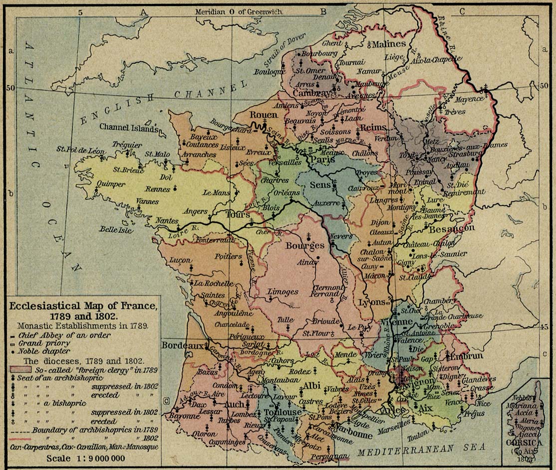
Español: Diócesis de Francia en 1789
Courtesy of the University of Texas Libraries, The University of Texas at Austin. Subject: Ecclesiastical Map of France, 1789 and 1802. From The Historical Atlas by William R. Shepherd, 1926. |
| 來源 | University of Texas Libraries, The University of Texas at Austin |
| 作者 |
William Robert Shepherd |
| Other versions | University of Texas |
協議
|
呢個作品喺來源國同埋其他版權期限係作者過身後70年或以下嘅國家同地區屬於公有領域。
| |
| This file has been identified as being free of known restrictions under copyright law, including all related and neighboring rights. | |
檔案歷史
撳個日期/時間去睇響嗰個時間出現過嘅檔案。
| 日期/時間 | 縮圖 | 尺寸 | 用戶 | 註解 | |
|---|---|---|---|---|---|
| 現時 | 2006年7月2號 (日) 04:58 | | 1,114 × 943(291 KB) | Cave cattum | == Description == '''Courtesy of the University of Texas Libraries, The University of Texas at Austin.''' '''Subject:''' Ecclesiastical Map of France, 1789 and 1802. From The Historical Atlas by William R. Shepherd, 1926. '''Source:''' [http://www.lib.u |
檔案用途
無嘢連來呢份檔案。
全域檔案使用情況
下面嘅維基都用緊呢個檔案:
- ast.wikipedia.org嘅使用情況
- az.wikipedia.org嘅使用情況
- ca.wikipedia.org嘅使用情況
- en.wikipedia.org嘅使用情況
- es.wikipedia.org嘅使用情況
- fr.wikipedia.org嘅使用情況
- ja.wikipedia.org嘅使用情況
- ko.wikipedia.org嘅使用情況
- la.wikipedia.org嘅使用情況
- lb.wikipedia.org嘅使用情況
- ro.wikipedia.org嘅使用情況
- sr.wikipedia.org嘅使用情況
- zh.wikipedia.org嘅使用情況